As this is my first post I thought I should introduce myself. I live in Kent and my interest is Kintyre is its connection to aviation history, particularly the many bombing ranges which is the main focus of my research. I know the locations of the ranges at Skipness, Crossaig and the multiple ranges around the Rhunahaorine Point area (official name was Ballure after the farm) as there are remains are visible today.
One of the ranges that I have yet to confirm is Killean. This was a bombing range for the Fleet Air Arm based at Machrihanish and I believe it was on the land between Tayinloan and Killean (NR 69054 45347?). It was opened in 1944 and contemporary documents give a danger area around the target of 600 yards radius. The area inside this would be clear of any obstructions and any spotting towers would be just outside this radius. It was probably closed at the end of the war but was brought back into use in 1952 due to the Korean crisis. Its final closure is not known.
The problem I have is that I cannot confirm any location as the aerial photos I have seen are either before it opened or after it closed. I was wondering if there was any local information as to ehere the target was and what it looked like and if there were any quadrant shelters or other buildings constructed to enable the fall of bombs to be plotted. Also was there an arrow laid out anywhere pointing to the target? Any help would be greatly appreciated.
I will be posting more queries at some point especially on another such range at Bellochantuy of which I have no location information.
Killean Bombing Range
8 posts
• Page 1 of 1
Killean Bombing Range
![]() by Peter Kirk » Sun Aug 21, 2016 11:48 am
by Peter Kirk » Sun Aug 21, 2016 11:48 am
- Peter Kirk
- Too Shy To Talk Much

- Posts: 3
- Joined: Sun Aug 21, 2016 10:45 am
Re: Killean Bombing Range
![]() by petewick » Mon Oct 10, 2016 3:04 pm
by petewick » Mon Oct 10, 2016 3:04 pm
Hello Peter,
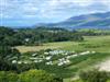
At Point Sands caravan site there is a building that looks like an observation post. There is one similar at Ballochroy just to the north.
At Point Sands caravan site there is a building that looks like an observation post. There is one similar at Ballochroy just to the north.
KGB
BALD AND EXPLOSIVE AN' JEEST GET THE BEER UP
BALD AND EXPLOSIVE AN' JEEST GET THE BEER UP
- petewick
- Forum Addict

- Posts: 1576
- Joined: Tue May 24, 2005 11:14 am
- Location: The Pluck Wid'
Re: Killean Bombing Range
![]() by jdcarra » Mon Oct 17, 2016 3:41 pm
by jdcarra » Mon Oct 17, 2016 3:41 pm
petewick wrote:Hello Peter,
At Point Sands caravan site there is a building that looks like an observation post. There is one similar at Ballochroy just to the north.
Peter, click on http://www.geograph.org.uk/photo/265228
- lookout.jpg (45.29 KiB) Viewed 16862 times
-
jdcarra - Forum Addict
- Posts: 1719
- Joined: Fri Dec 09, 2005 9:56 am
- Location: Carradale Glen
Re: Killean Bombing Range
![]() by skrik » Tue Oct 18, 2016 2:34 pm
by skrik » Tue Oct 18, 2016 2:34 pm
my old man trained at machrihanish at the start of the war he was a rear gunner night flyer in the fleet air arm and there is a chapter in the campbeltown book on the war ,I think there's one of those bunker brick lookouts there; kind regards kirk
- skrik
- Happy Camper

- Posts: 82
- Joined: Fri Jul 13, 2012 5:12 pm
Re: Killean Bombing Range
![]() by petewick » Thu Oct 20, 2016 3:08 pm
by petewick » Thu Oct 20, 2016 3:08 pm
The Sound of Gigha was used as a torpedo practice range by the Swordfish anti shipping planes.
They were byplanes and carried a single torpedo. Two man crew, pilot and tail gunner.
These two buildings would have been observation posts.
They were byplanes and carried a single torpedo. Two man crew, pilot and tail gunner.
These two buildings would have been observation posts.
KGB
BALD AND EXPLOSIVE AN' JEEST GET THE BEER UP
BALD AND EXPLOSIVE AN' JEEST GET THE BEER UP
- petewick
- Forum Addict
- Posts: 1576
- Joined: Tue May 24, 2005 11:14 am
- Location: The Pluck Wid'
Re: Killean Bombing Range
![]() by Peter Kirk » Sat Oct 22, 2016 8:33 pm
by Peter Kirk » Sat Oct 22, 2016 8:33 pm
Thank-you for the replies. I have quite a bit of information about the Ballure range (Point Sands area) and even a comment about the danger of heather catching fire when air to ground rocket firing was added to the range in 1944.
I suspect the Killean range would have used cheaper buildings as it was a late build, probably a curved roof Nissen type of hut with a large window facing the target.
Machrihanish must have been one of the busiest Naval Air Stations at the time with many bombing ranges under its control as well as a number of sea areas for bombing and, as mentioned, torpedo dropping.
- Peter Kirk
- Too Shy To Talk Much
- Posts: 3
- Joined: Sun Aug 21, 2016 10:45 am
Re: Killean Bombing Range
![]() by Novascot » Sun Oct 23, 2016 7:12 pm
by Novascot » Sun Oct 23, 2016 7:12 pm
Hi Peter
I grew up at Killean in the 1950's and I remember a small corrugated iron hut known as the "target hut". It was located on Killean land close to the shore and close to the march fence between Killean land and Largie(?) land. I don't remember any other buildings close by. You are correct in thinking that it was cheaply constructed. It may just have been blown down by winter gales!
I'm sorry I don't have more information for you. I haven't lived in Scotland for many years.
- Novascot
- Too Shy To Talk Much
- Posts: 1
- Joined: Sun Oct 23, 2016 6:14 pm
Re: Killean Bombing Range
![]() by Peter Kirk » Fri Nov 25, 2016 9:50 pm
by Peter Kirk » Fri Nov 25, 2016 9:50 pm
Thanks for the information on the hut. Hopefully I can spot it on aerial photographs of the period, although it sounds quite small.
- Peter Kirk
- Too Shy To Talk Much
- Posts: 3
- Joined: Sun Aug 21, 2016 10:45 am
8 posts
• Page 1 of 1
Return to Local History and Discussion
Who is online
Users browsing this forum: No registered users and 1 guest
Powered by phpBB © 2000, 2002, 2005, 2007 phpBB Group
Arrow Theme By Echo -=Designs By Echo=- © 2007 Echo