

Taddy Loch
15 posts
• Page 1 of 1
 by Sheik Yir Erse » Fri Mar 28, 2008 8:34 pm
Spangles - do you have an idea what year this was?
Sheik Baby Sheik (_/_) (_\_) (_/_) (_\_) (_/_) (_\_)
-

Sheik Yir Erse - Forum Addict

- Posts: 1300
- Joined: Thu Apr 27, 2006 11:27 pm
- Location: Jafansi aKebabhi
by spangles » Fri Mar 28, 2008 9:05 pm
No Castle park so could be any time pre 1920. Maybe even before WW1? The road on the right leading upwards would be the road to the rifle range which as you can see goes right through the Machrihanish railway tracks.
If you go into Historic Kintyre you can clearly see where the train headed for the Coal Ree past the Highland church and into Argyll Street where the coal was offloaded to be taken down to the boats in carts. Nothing to say the picture doesn't go as far back as the early 1900's. It looks like railway sheds on the right among the trees?.
S
If you go into Historic Kintyre you can clearly see where the train headed for the Coal Ree past the Highland church and into Argyll Street where the coal was offloaded to be taken down to the boats in carts. Nothing to say the picture doesn't go as far back as the early 1900's. It looks like railway sheds on the right among the trees?.
S
- spangles
by visitkintyre.info » Fri Mar 28, 2008 9:11 pm
Beat me to it Spangles but I knew I had a photo of taddy loch somewhere and it is on the Down Memory Lane site
http://www.visitkintyre.info/dml/
Same one but in black and white
Very, very interesting photo - would like to see a photo from the same perspective. Then and now - now there is another idea!


http://www.visitkintyre.info/dml/
Same one but in black and white
Very, very interesting photo - would like to see a photo from the same perspective. Then and now - now there is another idea!
- visitkintyre.info
- Happy Camper

- Posts: 77
- Joined: Mon Mar 10, 2008 10:52 pm
- Location: Kintyre
by mrn » Fri Mar 28, 2008 9:35 pm
Rabmacd wrote:Spangles,
isn't Taddy Loch up behind the Grammar School. That loch looks like its somewhere that Ralson Road now is--then again, it's Friday night. I might be looking at the photo upside doon
Spangles is correct. It is taddy loch. The road to the right is Ralston Road and where the trees are is the car park at the bottom of the school beside Kintyre Park. The Grammar School is a good few hundred yards to the right.
- mrn
- Active Poster

- Posts: 345
- Joined: Sun Apr 02, 2006 9:59 pm
- Location: West Road
by spangles » Fri Mar 28, 2008 9:36 pm
Hi Rab Taddy loch was behind where the cruden type houses start on the left on Ralson Road. Just up past the junction with Crosshill. When I went about it the water was full of rushes.
Away and have another wee tipple and look at it in the morning. :
S
Away and have another wee tipple and look at it in the morning. :
S
- spangles
by Rabmacd » Fri Mar 28, 2008 11:11 pm
Seriously noo, and pardon my ignorance,
but is there not a wee loch BEHIND the Grammar School called Taddy Loch.
MRN, I know the layout of the photo, but the "Taddy Loch" that I am thinking about was behind the grammar, somewhere round about the back of Hutcheon Court???
I seem to remember getting taddies from there.
but is there not a wee loch BEHIND the Grammar School called Taddy Loch.
MRN, I know the layout of the photo, but the "Taddy Loch" that I am thinking about was behind the grammar, somewhere round about the back of Hutcheon Court???
I seem to remember getting taddies from there.
- Rabmacd
- Forum Addict
- Posts: 1001
- Joined: Thu Feb 24, 2005 7:04 pm
by Ship called Dignity » Sat Mar 29, 2008 12:22 am
Rabmacd wrote:Seriously noo, and pardon my ignorance,
but is there not a wee loch BEHIND the Grammar School called Taddy Loch.
MRN, I know the layout of the photo, but the "Taddy Loch" that I am thinking about was behind the grammar, somewhere round about the back of Hutcheon Court???
I seem to remember getting taddies from there.
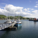
Is this where you are on about Rab? To the right? Mair like a puddle.

-
Ship called Dignity - Forum Addict
- Posts: 6025
- Joined: Wed Feb 02, 2005 10:50 pm
- Location: Campbeltown
by Rabmacd » Sat Mar 29, 2008 1:43 am
The very one Davie, though the splendour doesn't show up on Google EARTH. Google Lochs is what you should be looking for 
That Taddy thing wasn't much more than a puddle either then. I can remember running right through it in my old Tomkinson's Schooldays Ripping Yarns, cross country running days
That Taddy thing wasn't much more than a puddle either then. I can remember running right through it in my old Tomkinson's Schooldays Ripping Yarns, cross country running days
- Rabmacd
- Forum Addict
- Posts: 1001
- Joined: Thu Feb 24, 2005 7:04 pm
by EMDEE » Sat Mar 29, 2008 2:55 am
Rabmacd wrote:Spangles,
isn't Taddy Loch up behind the Grammar School. That loch looks like its somewhere that Ralson Road now is--then again, it's Friday night. I might be looking at the photo upside doon
Petewick mentioned this loch on the "I remember when" thread. Personally I had never heard of any other body of water being called Taddy Loch other than the one behind Ralston Road, although that area behind Limecraigs was not an area I frequented in my youth. I was more Albyn/Davaar/Calton/Hillside. I would agree with Rabmacd that in its latter days the one behind Ralston Rd had become no more than a puddle, as I watched it getting smaller year by year.
The reason I am aware of Taddy Loch is that my granny lived in Crosshll Avenue, and I spent a lot of time in that part of the town. At the time when I used to frequent it, it was just a vestige of its former size, as I can see from the photos. We got plenty of taddies there nevertheless. I suppose you can get taddies anywhere. We get them in the pond in our garden, and it has only been there for five years.
Back to the photo. I see that there is a road running off Ralston Road. Is this the present Meadows Avenue? The reason I ask this is because in the photo it looks to be very near to the old Waterhouse in the garden of 8 Crosshill Avenue.
Merda taurorum animas conturbit. Quidquid latine dictum sit, altum videtur
-

EMDEE - Forum Addict
- Posts: 1932
- Joined: Wed Sep 20, 2006 10:55 am
- Location: Up the Rodd
by spangles » Sat Mar 29, 2008 10:41 am
EMDEE wrote:Back to the photo. I see that there is a road running off Ralston Road.
Ralston Road didn't exist then Emdee, I believe that is the Machrihanish railway line running alog the middle of the picture. If you look to the right in the trees you can see the coal ree where they carted the coal down to the peir from Argyll Street. Is that carriages sitting on the siding?
I have "borrowed" this link from the "Historic Kintyre" site to show the track running through the rifle range road before it started to climb to Tomaig. The above photo is more to the left of that map.
http://www.campbeltownloch.com/photogal ... hoto_id=67
Ralston Road as we know it stopped at the old Grammar school in that picture. The road you see running up on the right of the picture is up to the rifle range. That road would be done away with when the scheme was built and a new road put in a good number of metres to the East to run on the other side of the cottage which now makes up part of Meadowpark sheltered housing complex.
EMDEE wrote:The reason I ask this is because in the photo it looks to be very near to the old Waterhouse in the garden of 8 Crosshill Avenue.
Emdee the water house was in the garden of number 9 across the road from number 8. The tenant that is in there now asked for it to be moved approx. 3 years ago.
S
- spangles
by EMDEE » Sat Apr 05, 2008 6:34 pm
Been doing a bit of research on the history of Taddy Loch, and find that there is reference to it in “The Whisky Distilleries of Campbeltown” by David Stirk. (2005)
According to the book, what we knew as “Taddy Loch” was a holding reservoir which was completed in 1820, and was built by John Campbell, the seventh Duke of Argyll, to help to develop the whisky industry in the town, as he saw the availability of process water for distilling to be a problem to the industry.
It seems that the Duke foresaw that legislation that was finally passed in 1823 would lead to an upsurge of whisky distilling in the town, and saw a business opportunity. As it turned out, this was indeed the case, although the industry was almost wiped out in later years.
As a point of interest, the inside front and back covers of the book are the north and south parts of an old 19th Century map of the town. On this map, the road that we see in the above photo, that we now know as Ralston Road, ending abruptly where the gate of the playing fields now is, is named as “Rope Walk”. Where did this name come from? Any fishing connection?
According to the book, what we knew as “Taddy Loch” was a holding reservoir which was completed in 1820, and was built by John Campbell, the seventh Duke of Argyll, to help to develop the whisky industry in the town, as he saw the availability of process water for distilling to be a problem to the industry.
It seems that the Duke foresaw that legislation that was finally passed in 1823 would lead to an upsurge of whisky distilling in the town, and saw a business opportunity. As it turned out, this was indeed the case, although the industry was almost wiped out in later years.
As a point of interest, the inside front and back covers of the book are the north and south parts of an old 19th Century map of the town. On this map, the road that we see in the above photo, that we now know as Ralston Road, ending abruptly where the gate of the playing fields now is, is named as “Rope Walk”. Where did this name come from? Any fishing connection?
Merda taurorum animas conturbit. Quidquid latine dictum sit, altum videtur
-
EMDEE - Forum Addict
- Posts: 1932
- Joined: Wed Sep 20, 2006 10:55 am
- Location: Up the Rodd
15 posts
• Page 1 of 1
Return to Local History and Discussion
Who is online
Users browsing this forum: No registered users and 40 guests
Powered by phpBB © 2000, 2002, 2005, 2007 phpBB Group
Arrow Theme By Echo -=Designs By Echo=- © 2007 Echo

